Interactive Map of AZ weather stations
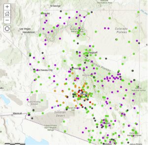
Click on the map to access weather station details
Public Data Access
NWS Phoenix area stations
NWS Flagstaff area stations
NWS Tucson area stations
NWS Kingman area stations
Climate Charts
NWS Central AZ stations
NWS N Arizona stations
NWS SE Arizona stations
NWS NW Arizona stations
Clickable ASOS data
Clickable Long-term data
Clickable CO-OP data
Clickable Hydro data (DCP)
Clickable Road data (RIWS)
Interactive map AZ ASOS IDs
- Global Hourly Integrated Surface Database Hourly Data
Download ASOS stations: Launch Global Hourly; Where: Arizona (shows all AZ stations)
Historical Observing Metadata Repository NCEI metadata
What is ASOS?
Automated Surface Observing System
- XM ACIS2 Data Station Data
- Global Historic Climatology Network Online
- All NCDC-NCEI Climate Data Online
- NCDC Storm Event Reports Online
- High Plains Regional Climate Center Online Data Sources
- Synoptic Data Mesonet (RAWS, etc.) Online
- Iowa Environmental Mesonet (AZ ASOS) Online
- NOAA RCC SC ACIS (COOP, CoCoRaHS, etc.) Online
- Threaded Station Extremes Online
- Arizona Cooperative Stations Climate Data
- MesoWest – Arizona Data
- Arizona Meteorological Data AZMET
- Tips to download RAWS data RAWS
- Precipitable Water Current
Flood Control District of Maricopa County
Pima County Regional Flood Control District
Yavapai County Flood Control District
Coconino County ALERT Display
Arizona Flood Warning System Map
Map of Phoenix area weather stations NWS, AZMET, FCDMC
Map of AZ ASOS weather stations AZ ASOS
- Arizona Climate Extremes
- State Climate Extremes
- National High and Lows
Additional Maps
Forecast Maps
Wind Maps
- Wind Map United States
- Earth Nullschool Wind Map Global
Lightning Maps
- Daily Lightning Climatology Map United States
Climate Maps
- SERCC Rankings Historic Rankings Maps
- SERCC Rankings WRCC Current Maps
- ACIS Climate Archive Maps Archive Maps
- U.S.Climate Normal PRISM Maps
- U.S. Temperature and Precipitation Climate.gov Maps
- NCEP Monthly Reanalysis Maps
- NCEP Daily Reanalysis Maps
- NCEP Global Monthly Reanalysis Maps
- All available Reanalysis types Maps
Water/Drought Maps
- National Resources Conservation Service SWE/Snow/Soil Moisture Maps
- WestWide Drought Tracker Archive Archive Maps
- Drought Monitor Map Archive Archive Maps